What Is CFS and Why Does It Matter?
CFS stands for cubic feet per second. It measures the volume of water moving past a fixed point in a river every second. One CFS is roughly equivalent to about 7.5 gallons of water flowing past that point per second, which gives you a sense of how quickly even modest flow numbers add up.
For rivers, CFS is the most reliable indicator of conditions because it captures both volume and speed together. A river at 500 CFS behaves very differently from the same river at 2,000 CFS. The banks are wider, the rapids are more powerful, the hydraulics are more complex, and the consequences of a swim are more serious.
On the Salt River, CFS is the number that guides our entire season planning. It tells us when the river is safe to run, when it’s at its best, and when it has dropped too low to operate trips safely. It’s not just a data point. It’s the heartbeat of the season.
CFS at a Glance
|
How the Salt River Gets Its Water
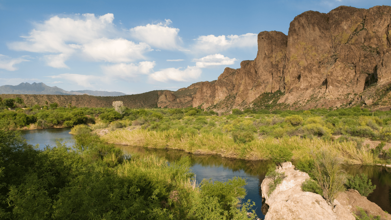
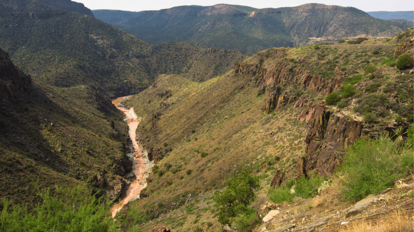
The Upper Salt River is a snowmelt-fed river. Unlike rivers that draw from consistent groundwater or large reservoir systems, the Salt River depends almost entirely on precipitation and snowpack in the White Mountains of eastern Arizona.
Here’s how the cycle works. Winter snowfall accumulates in the mountains at elevations above 7,000 feet. As temperatures warm in late February and March, that snow begins melting and draining into the river system through a network of tributaries. The White River, the Black River, and several smaller streams all feed into the Salt River before it enters the canyon.
This is why the Salt River’s season is so closely tied to Arizona’s winter weather. A cold, wet winter with heavy mountain snowfall produces a strong snowpack, which in turn produces a long, high-flow spring season. A dry winter or an early warm spell that melts the snowpack too quickly can result in a season that never materializes, or one that arrives and disappears in a matter of weeks.
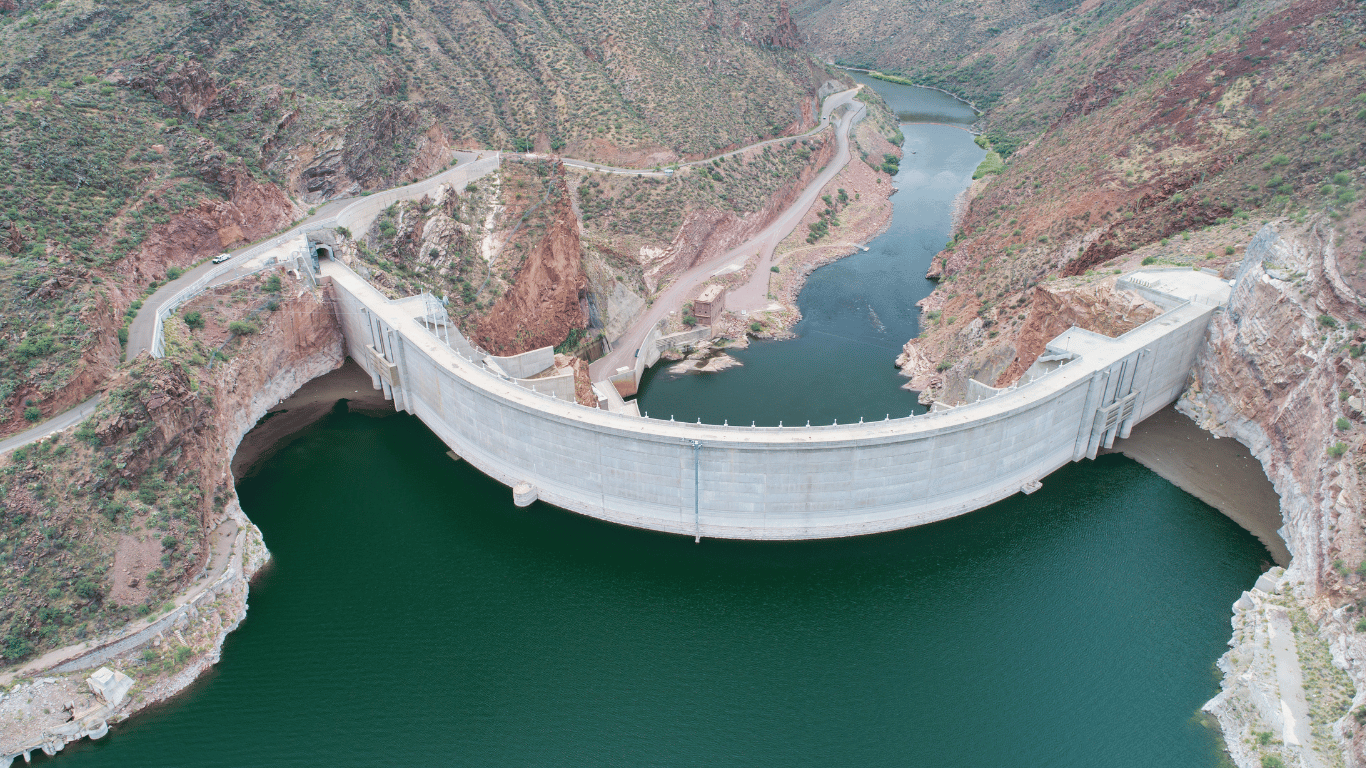
It’s also why the river doesn’t run every year. Unlike the Colorado River or the Colorado’s larger tributaries, which are regulated by dams and reservoirs, the Salt River above the canyon is wild and unregulated. What you see on the gauge is exactly what nature delivered.
What Feeds the Salt River
Primary source: Winter snowpack in the White Mountains of eastern Arizona
Key tributaries: White River, Black River, and smaller mountain streams
Peak melt period: Late February through April depending on temperatures
No upstream dam regulation on the Upper Salt River
Flow varies dramatically year to year based on winter precipitation
What CFS Range Is Needed to Run the Salt River?
This is the question we get asked more than any other. The short answer is that the Salt River generally needs to be running at a minimum of around 800 to 1,000 CFS before we can safely operate trips. Below that threshold, the river becomes too shallow in key sections, certain rapids become technical in ways that increase risk, and the overall experience suffers.
But minimum runnable flow is just the floor. The ideal range is quite different.
| Flow Level (CFS) | Conditions | Trip Suitability |
|---|---|---|
Below 800 | Too shallow. Rocky exposure in key rapids. Not runnable. | No trips |
800 to 1,500 | Low but runnable. Technical in spots. More maneuvering required. | Half-day and full-day with experienced guides |
1,500 to 3,500 | Ideal range. Fast, exciting, consistent rapids. Best overall experience. | All trips. Prime conditions. |
3,500 to 6,000 | High water. More powerful hydraulics. Experienced guides essential. | All trips. More intense experience. |
Above 6,000 | Very high water. Significant hazard increase. Careful assessment required. | Case by case. Safety first. |
Above 10,000 | Flood conditions. River not runnable safely. | No trips |
These ranges are guidelines, not hard cutoffs. Every season is different and our guides assess conditions at the put-in before every trip. Flow can change significantly within a single day based on upstream snowmelt rates, overnight temperatures, and precipitation.
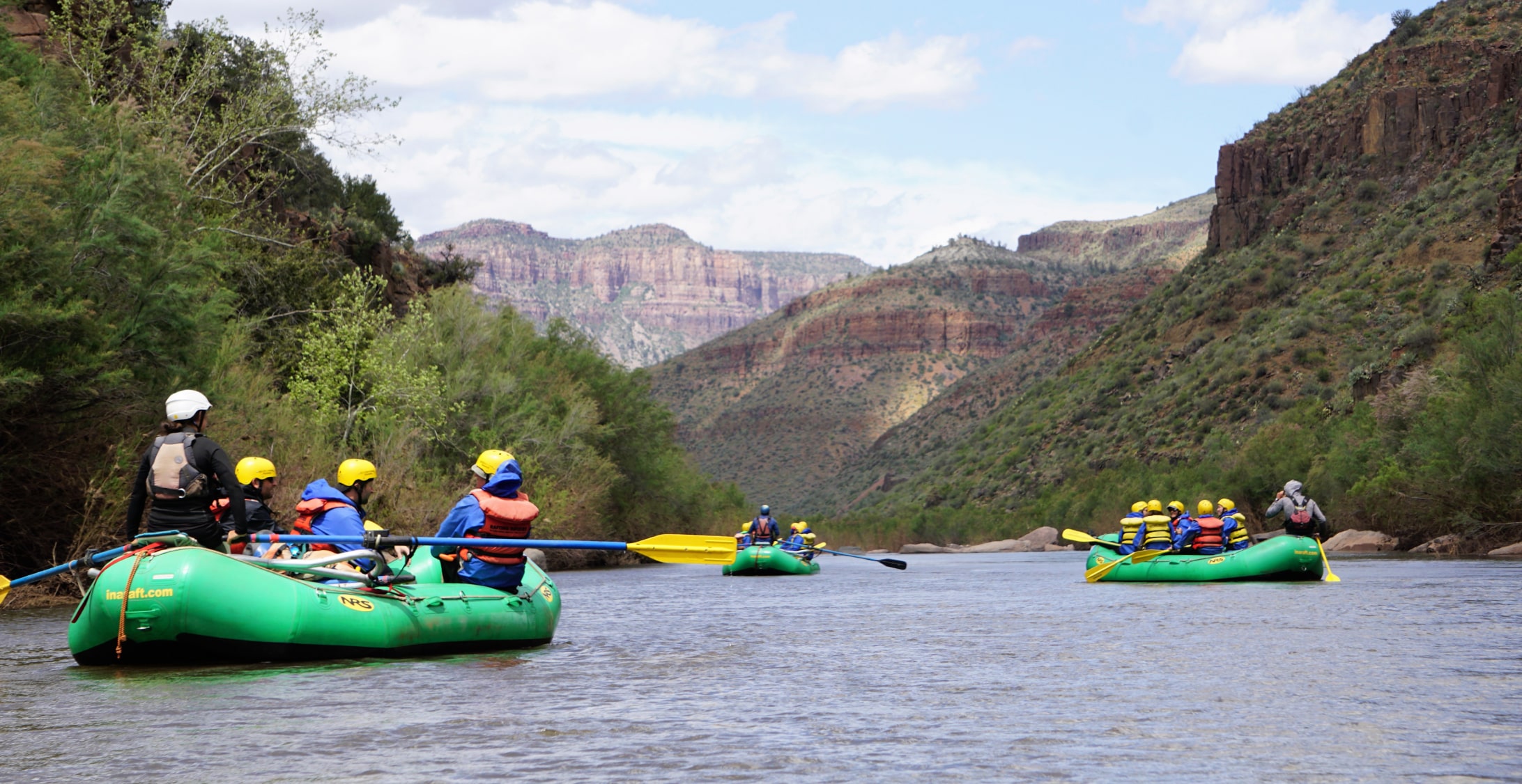
How Flow Level Affects Your Rafting Experience
One of the most common misconceptions about river rafting is that more water always means more fun. The reality is more nuanced. Different flow levels produce different kinds of experiences, and the best level for you depends on what you’re looking for.
Low Water: 800 to 1,500 CFS
At low flows, the river is more technical. Your guide has to read the water carefully to find the best lines through rapids, and there’s more boat-to-rock proximity. This can actually be a fascinating experience for guests who enjoy watching skilled river navigation up close. The trade-off is that certain sections require more paddling effort and some of the larger hydraulic features are less dramatic.
Wildlife sightings tend to be excellent at lower flows because the river is quieter and animals are less disturbed by fast-moving water.
Ideal Water: 1,500 to 3,500 CFS
This is the sweet spot. Rapids are full and consistent. The hydraulic features that make named rapids like Quartzite Falls exciting are fully formed. Boats move at a satisfying pace between rapids, and the river has enough volume to flush cleanly through the canyon. First-timers and experienced rafters alike tend to rate trips in this range the highest.
If you’re hoping to book a trip and the gauge is reading somewhere in this range, don’t hesitate. These are the conditions you want.
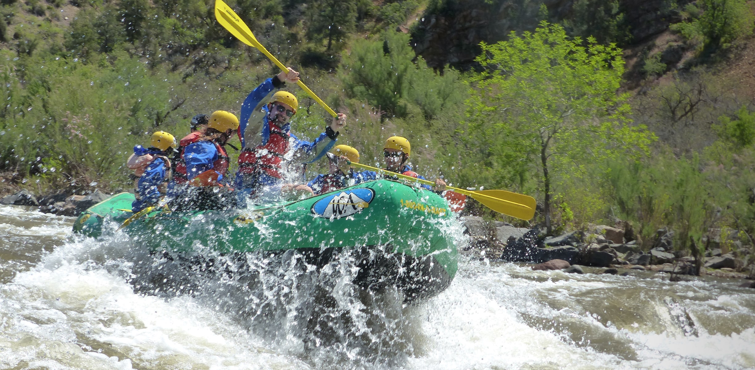
High Water: 3,500 to 6,000 CFS
High water is a different kind of exciting. The river moves faster, the waves are bigger, the hydraulics are more powerful, and the margin for error narrows. Our guides are trained to run the Salt River across a wide range of flows, but high-water trips require a higher level of attention and physical engagement from guests.
If you’re a first-timer and the river is running above 4,000 CFS, our team will talk you through what to expect and make sure you’re in the right boat with the right guide. High water trips are absolutely doable for beginners but they require more focus.
Very High Water: Above 6,000 CFS
At very high flows, the Salt River becomes a serious whitewater challenge. Certain rapids change character entirely as features wash out and new hydraulics form. Our guides evaluate these conditions on a case-by-case basis. We run trips at high water when conditions are safe to do so and we cancel or modify trips when they’re not. Guest safety is never negotiable.
How to Read the Salt River Flow Gauge
The primary gauge used to monitor Salt River conditions is operated by the United States Geological Survey (USGS). It’s located at a fixed point along the river and records flow data continuously, updating roughly every 15 minutes.
You can access real-time gauge data directly on our Salt River Conditions page, where we embed the USGS flow graph and provide regular updates during the season. You can also access the raw USGS data directly at waterdata.usgs.gov.
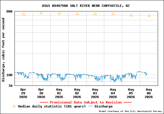
When you look at the gauge graph, here’s what you’re seeing:
The vertical axis (Y-axis): This shows flow volume in CFS. Higher on the graph means more water.
The horizontal axis (X-axis): This shows time, typically displayed as a rolling 7-day or 30-day window.
The line itself: This traces the actual recorded flow over time. A rising line means snowmelt is actively feeding the river. A falling line means flows are dropping.
Flat periods: These often occur overnight when temperatures drop and snowmelt slows. Flows tend to peak in the afternoon when daytime warming accelerates melt.
One thing to keep in mind: the gauge reflects conditions at one specific point on the river. Conditions can vary between the put-in and takeout, particularly when major tributaries enter between those points. Our guides account for this variability when planning each day’s trips.
What Makes a Good Season vs. a Marginal One
Not all Salt River seasons are created equal. A good season is characterized by sustained flows in the ideal range for an extended period. A marginal season might hit minimum runnable flows for a few weeks before dropping out. An exceptional season can run from early March all the way through May.
The factors that determine season quality are almost entirely set during the winter months, well before spring arrives:
Total Snowpack Accumulation
The volume of snow that accumulates in the White Mountains over the winter is the single biggest factor. The Natural Resources Conservation Service (NRCS) monitors Arizona snowpack throughout the winter and publishes regular reports. A snowpack reading at or above 100 percent of the historical median in the relevant mountain zones is a strong indicator of a viable rafting season.
Timing of the Warm-Up
Even a strong snowpack can produce a disappointing season if the warm-up comes too early or too fast. A rapid early warm spell can spike the river to very high flows for a short period and then drop it below runnable levels before most guests can book. A gradual warm-up through March and April produces slower, sustained melting, which is what keeps the river in the ideal range for the longest possible time.
Late-Season Precipitation
Rain events in March and April can extend the season significantly by supplementing the snowmelt. These aren’t always predictable but they’re a welcome addition when they arrive.
Temperature Patterns
Overnight lows matter almost as much as daytime highs. Cold nights slow the melt and help moderate the flow, keeping the river in a more consistent range from day to day. Warm nights accelerate overnight melt and can produce higher-than-expected morning flows.
Historical Salt River Season Overview
Because the Salt River depends on natural snowmelt rather than regulated releases, its season varies considerably from year to year. The table below gives a general sense of how seasons have varied historically. This is not an exhaustive record but it provides useful context for understanding the river’s patterns.
| Season Type | Snowpack Conditions | Approximate Run Period | Peak Flow Range |
|---|---|---|---|
Exceptional | 150%+ of median snowpack | Early March through May | 3,000 to 6,000+ CFS |
Strong | 100 to 150% of median | Mid-March through late April | 1,500 to 4,000 CFS |
Moderate | 75 to 100% of median | Late March through mid-April | 1,000 to 2,500 CFS |
Marginal | 50 to 75% of median | Brief window, often 2 to 4 weeks | 800 to 1,500 CFS |
No Season | Below 50% of median | River does not reach runnable flow | Below 800 CFS |
The Salt River runs roughly once every two to three years at levels sufficient for a full rafting season. In years when it doesn’t run, the experience of those who do get to run it becomes that much more valued. Guests who have been waiting for the right year often describe the trip as worth every year of waiting.
How to Stay Informed About Current Conditions
The most reliable way to stay up to date on Salt River flow conditions is to check our conditions page regularly and sign up for season notifications.
Salt River Conditions Page: Live USGS flow data embedded on our site with plain-English updates from our team during the season.
Season Waitlist: Join our list to be notified the moment we confirm the season is open for bookings. We announce openings to waitlist members before anyone else.
USGS WaterWatch: The USGS national streamflow monitoring tool at waterdata.usgs.gov provides raw gauge data for the Salt River gauging station directly.
NRCS Snowpack Reports: The Natural Resources Conservation Service publishes Arizona basin snowpack reports throughout winter. These are the best early-season predictor of whether the Salt River will run.
During an active season, our team updates the conditions page regularly. During off years, we post an end-of-season note and keep the page updated with information about what to watch for the following winter.
Understanding the River Before You Arrive
The Salt River’s flow conditions are what make it one of the most distinctive rafting destinations in the American Southwest. Unlike rivers that run on schedule because of upstream dam releases, the Salt River runs when the mountains say it runs. That unpredictability is part of its character.
Knowing what CFS means, what range produces the best experience, and how to track the gauge yourself puts you in a much better position to plan your trip, understand the season, and appreciate what you’re getting into when you step into a raft.
Want to Know When the 2027 Season Opens?The Salt River is not running in 2026. But the snowpack conversation starts again this fall, and when conditions look promising we’ll be the first to let you know. Join the waitlist and get notified the moment we open 2027 bookings. Waitlist members get first access before dates are announced publicly. |