EXPLORE OUR REGION
SALT RIVER MAPS
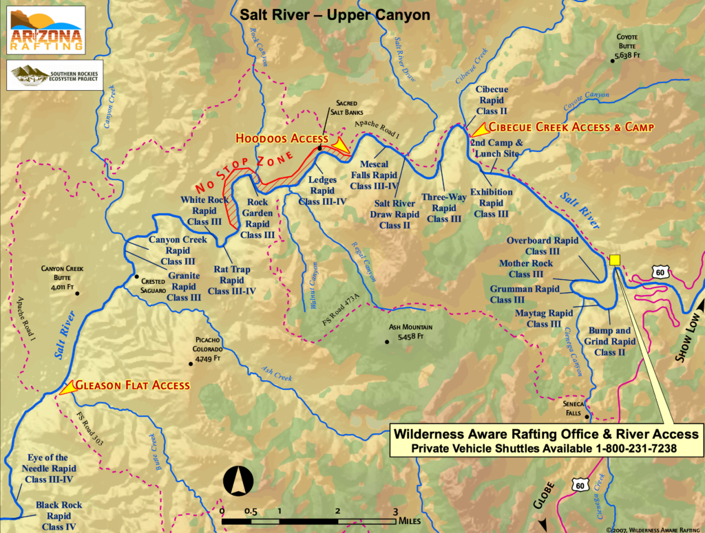
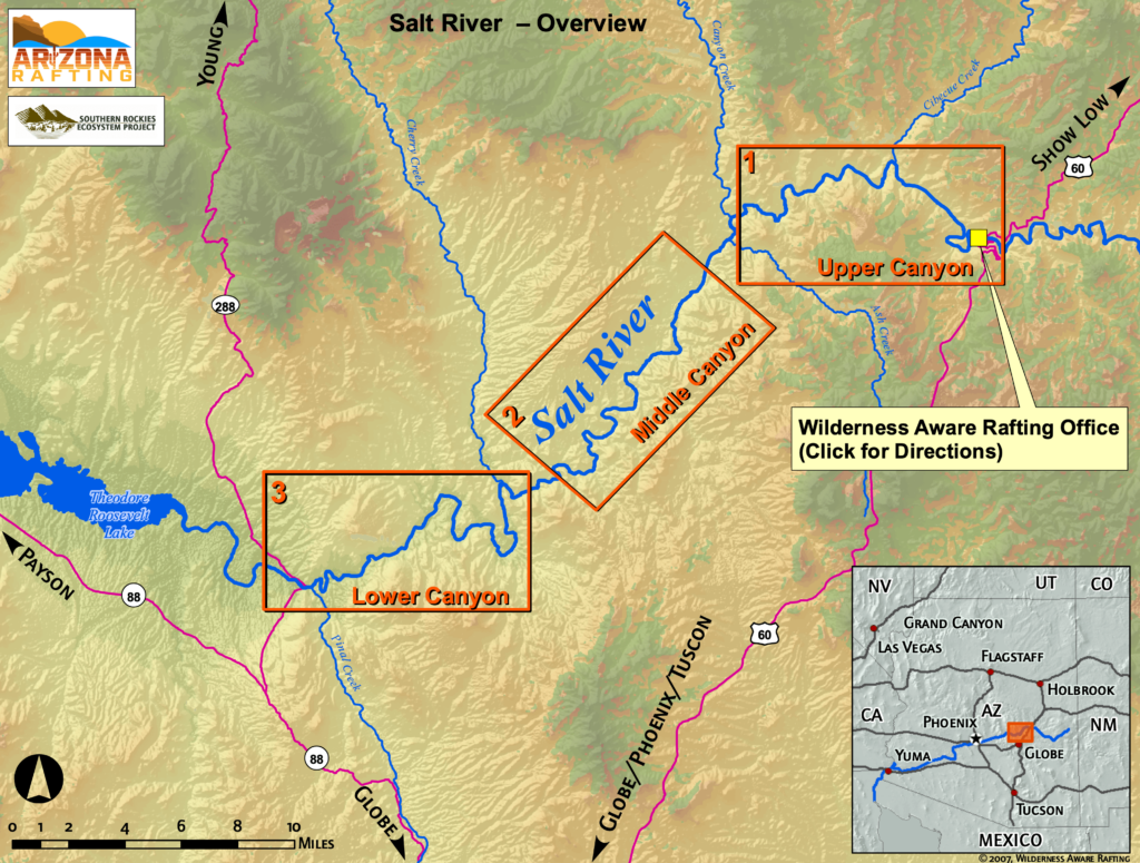
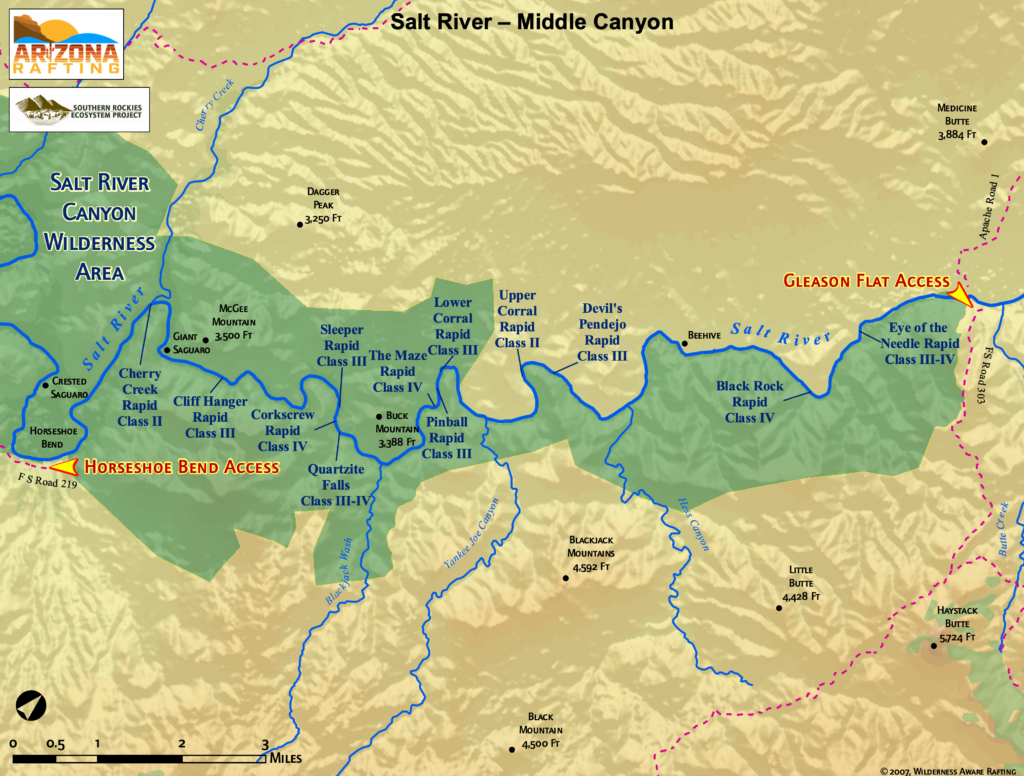
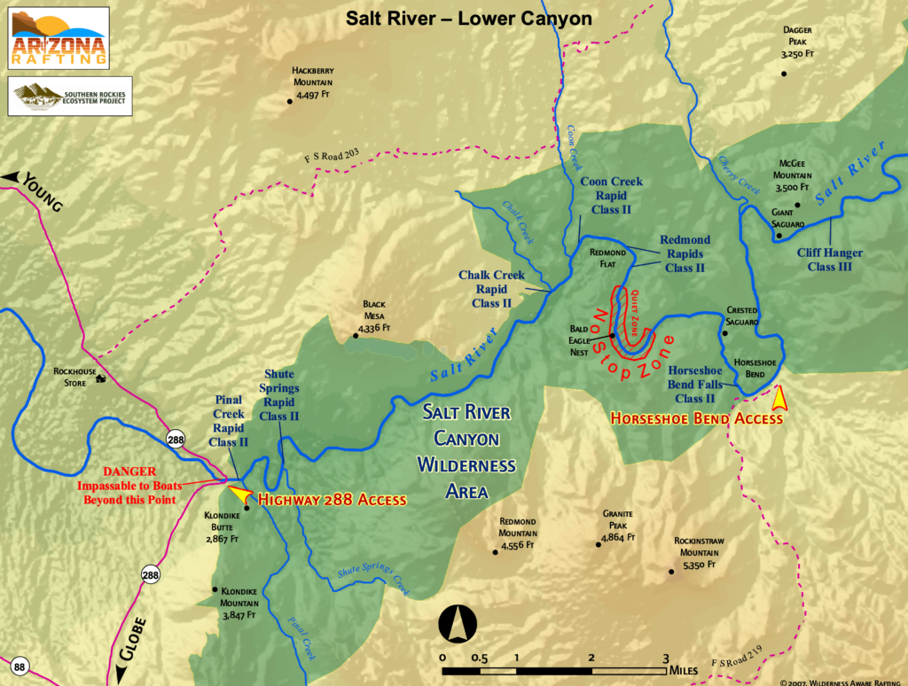
View Arizona Rafting’s descriptive Salt River Arizona maps below for detailed information about the upper section of Arizona’s Salt River, as there are three very distinct sections along its 52-mile length—the Upper Canyon, Middle Canyon and Lower Canyon.
From this page, you can see where the Salt River is located in Arizona, an overview map of the three sections, and specific river maps of each canyon showing access points, rapids, and other interesting features. Enjoy!
If you’re looking embark on a Salt River rafting trip with the pros, we offer a number of different Salt River white water rafting trip options. Whether or not you choose a guided trip, we hope you enjoy white water rafting in Arizona!
SPOTS ARE FILLING FAST!
BOOK YOUR TRIP NOW
Choose from half-day and full-day trips white water rafting in Arizona on the Salt River. We offer trips up to five days long. Here’s what you could be missing out on:
