HIGHWAY 60 BRIDGE TO HIGHWAY 288 BRIDGE
SALT RIVER RAFTING SECTIONS
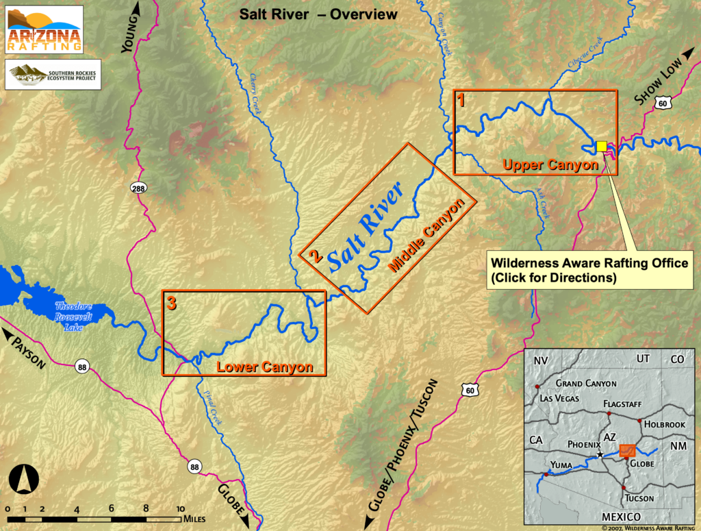
This map gives an overview of all the rafting sections of the Salt River in Arizona. All Salt River rafting trips originate at our satellite office at the bottom of the Salt River Canyon found on the Upper Canyon Map.
Multi-day Salt River trips continue through the Middle and Lower Canyons terminating at the Hwy 288 bridge.
Find details for each section below, including rapid names.
A printer-friendly, souvenir-quality version of this map is great to bring along when visiting us.

SPOTS ARE FILLING FAST!
BOOK YOUR TRIP NOW
Choose from half-day and full-day trips white water rafting in Arizona on the Salt River. We offer trips up to five days long. Here’s what you could be missing out on:
Miles of River
0
Named Rapids
0
Days of Sunshine
250


