PLAN AHEAD
DIRECTIONS & MAP TO OUR OFFICE
Note: There is NO physical address for our Arizona whitewater rafting office. Please use the map below along with your pre-trip information as you make your way to the river.
Our satellite/mobile office is located just off of US Hwy 60 East/AZ Hwy 77 North at the bottom of the Salt River Canyon, 45 minutes north of Globe, about 2.5 hours east of Phoenix, and 2.5 hours north of Tucson.
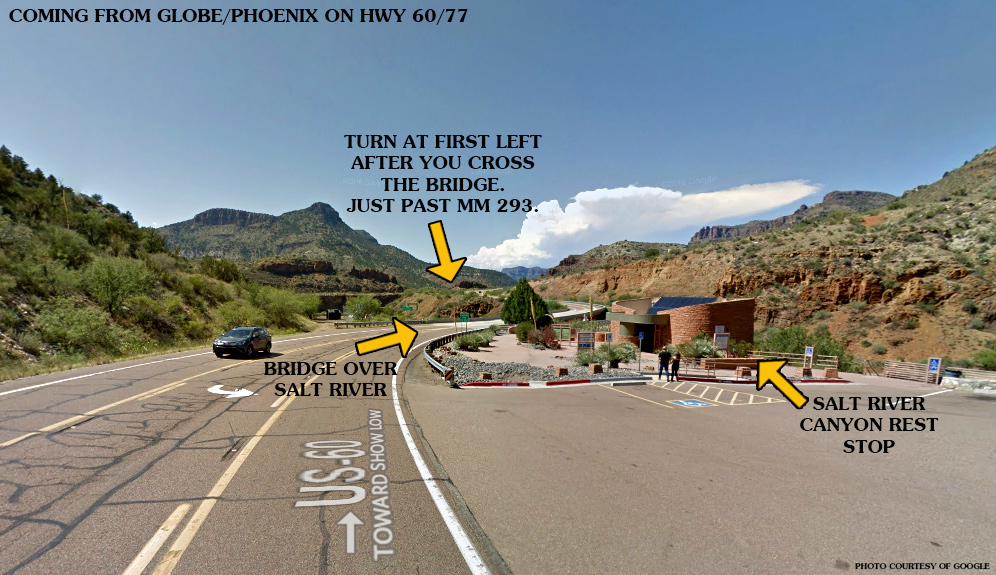
When traveling north from Globe, turn LEFT just after the bridge that crosses the Salt River, just after mile marker 293.
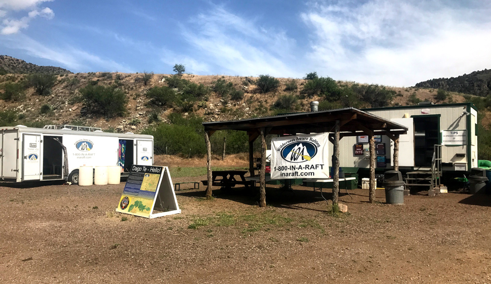
Look for Arizona Rafting on your right. Park near our office trailers.
It is EXTREMELY important that you allow adequate travel time! Remember that you must show up 30-45 minutes before your trip departure time. To get an idea of how long the drive takes, click here to see the distance to Arizona Rafting from cities in Arizona.
Directions from Phoenix
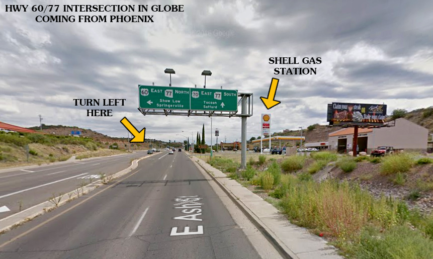
- Take Hwy 60 East out of Phoenix, toward Globe.
- Travel on Hwy 60 through Miami and into Globe, continuing east on Hwy 60 (Ash Street) THROUGH the town of Globe.
- You will pass a McDonald’s restaurant on the right, after which you will see signage directing you to turn left on US Hwy 60 EAST / AZ Hwy 77 NORTH toward Show Low/Springerville at the next intersection. There is a Shell gas station at this intersection.
- Once you are headed toward Show Low on US Hwy 60 EAST / AZ Hwy 77 NORTH, travel about 45 minutes (start at mile marker 253 and finish at mile marker 293) and turn LEFT just after the bridge that crosses the Salt River, JUST after mile marker 293.
At the base of the Salt River Canyon, between mile markers 292 and 293 there is a developed rest stop. Our office is located just after the rest stop, over the bridge and to the left.
Directions from Tucson
- Take Hwy 77 North out of Tucson, toward Globe.
- Two miles before you reach Globe, you will arrive at the intersection of Hwy 77 and Hwy 70. TURN LEFT at this stop sign.
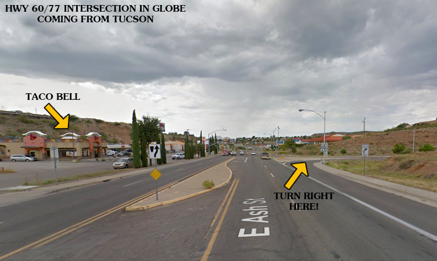
- As you travel two miles toward Globe, you will see signage directing you to turn right on US Hwy 60 EAST / AZ Hwy 77 NORTH toward Show Low/Springerville. There is a Taco Bell restaurant and Shell gas station at this intersection.
- Once you are headed toward Show Low on US Hwy 60 EAST / AZ Hwy 77 NORTH, travel about 45 minutes (start at mile marker 253 and finish at mile marker 293) and turn LEFT just after the bridge that crosses the Salt River, JUST after mile marker 293.
Directions from Flagstaff
- From Flagstaff, get on I-40 East from Historic Rte 66
- Follow 1-40 (1hr 15min or 86.4mi) to exit 285 (South Hwy 77 to Show Low)
- Turn right on US-180 W Hopi Dr in Hollbrook
- Turn Right on Navajo Blvd (Hwy 77), follow to Show Low – (55min or 48.6 miles)
- Turn Right onto Hwy 60/AZ 77 (55 min or 47.5 miles)
- At the bottom of the Salt River Canyon, watch for your Right turn onto a dirt road. If you cross the bridge and arrive at the Black and Salt Recreation Area rest stop, you missed us. Turn around.
Looking for a Shuttle?
During our season, we offer private permit holders vehicle shuttle from Hwy 60 to the Hwy 288 take out. Please click below for more information and a booking form for vehicle shuttles.
SPOTS ARE FILLING FAST!
BOOK YOUR TRIP NOW
Choose from half-day and full-day trips white water rafting in Arizona on the Salt River. We offer trips up to five days long. Here’s what you could be missing out on:
